Most of the rest of our time in New Zealand was spent chasing my dreams of visiting Middle Earth. If you aren’t a Lord of the Rings fan, no worries, New Zealand is beautiful enough to appreciate aside from the films.
From Wellington we rented a car and went North to Lake Taupo where we had rented an Airbnb for the night. We originally planned on taking buses during our time here but through reading other people’s blogs we learned that in New Zealand, so many people rent cars in Auckland and go south that many rental companies offer vehicle relocation deals for cheap or free if you are traveling South to North. We missed out on the free ones, but got a deal good enough to skip out on buses. Kirk had past experience driving on the left side of the road, and I do now too ;).

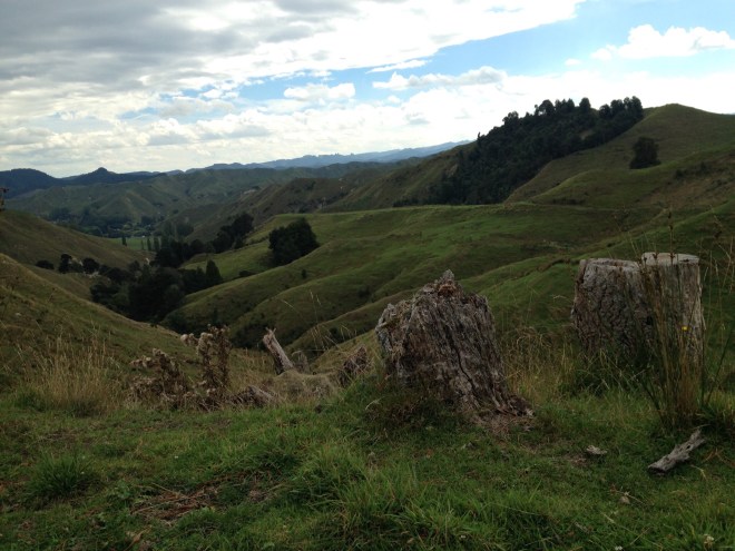
The ride up highway 4 (which we actually ended up on because we missed a turn) was one of my favorite parts of New Zealand. The pictures don’t do the miles of rolling green hills and little white sheep justice. There were look outs posted every few kilometers and we drove slowly, stopping to take in the beauty around us pretty often. We stopped for lunch and ate take out on the beach. It was a good day.
😍

I was a pretty big fan of the single tree growing on the very top of the hill, roots framing the crest.
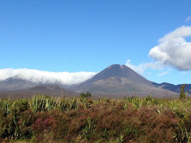
From there we were very close to the Tongariro Alpine Crossing, which we’ve been told is the most beautiful hike in New Zealand. It’s free to get into the park, but it’s a one way hike and you have to pay for a bus to return to your car on the other side of the park. 19.4 kilometers that pass between Mount Tongariro and Mount Ngauruhoe – the stratovolcano used in Lord of the Rings to represent Mt. Doom. I spent the evening before the hike looking up blogs and photos to see what we would see – the pictures looked so beautiful! Emerald lakes in the middle of black volcanic stone. A red crater left from a previous volcanic eruption. A brilliant blue lake that you aren’t allowed to touch because the locals consider it sacred and a view of the city from one of the highest points around.
The next morning we got up early and began the hike with 100’s of other people hoping to see the views. They told us that on some weekends thousands of people will pass through on a single day. Thankfully we went on a weekday, but we were still back to back with people the whole first half of the hike (Torres Del Paine was the opposite – we rarely passed people except people headed in the opposite direction).
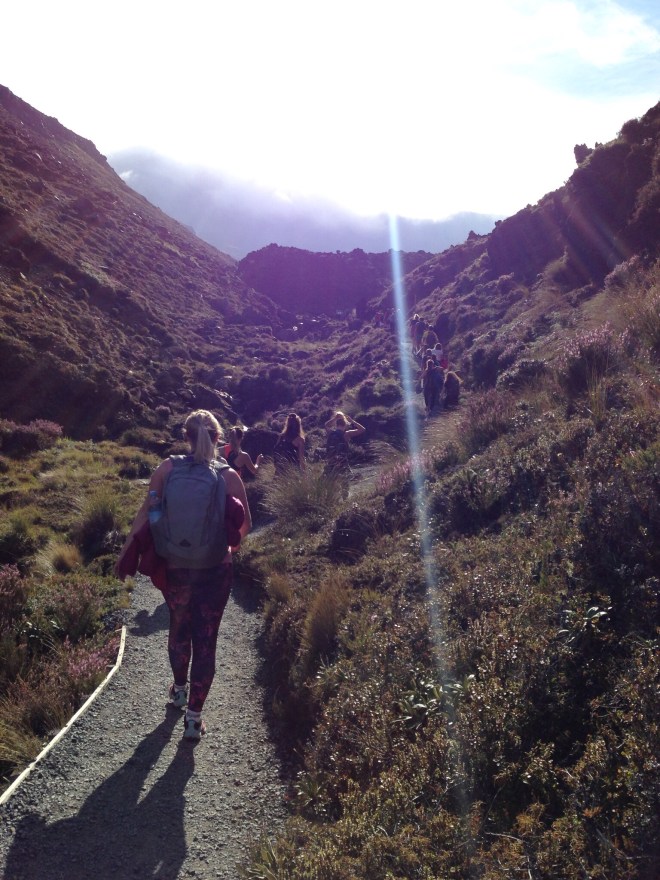
Starting the hike with a line of people.
The beginning of our hike was beautiful. Fields of purple flowers and frosty moss growing all around the desolate volcano. We watched as the sun rose behind the mountain, thankful we’d remembered our sunglasses.

“Mt. Doom” with the mossy field

The sun rising up behind the volcano/mountain.

The look back after hiking several kilometers
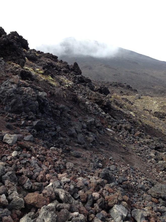
The beginning of the trail is mostly flat, but about 4 kilometers in you come to a sign that basically says “Turn back now if you aren’t ready for this” with other warnings about risk of volcanic activity. We continued up and found ourselves hiking in some of the most desolate looking places, which held a beauty of their own.
 —
—
From there, we went up. Everyone on the trail took turns resting and passing one another until we arrived to a top. A top, with three surprising things.
1) It was flat, completely flat. I’m assuming the first level you come to must be some type of crater because it levels off for a suprisingly long time.

Me on part of the flat ground.
2) There were children. At the top of the first level we turned left and saw a group of around 100 boys, probably near age 10. Apparently a scouts group took a trip and camped out there. Every boy had a huge backpack on, some almost bigger than themselves. Kirk and I were shocked and impressed. This hike is not for the faint of heart and it’s also pretty treacherous! There are many high cliffs to pass over and around and also a steep sandy bank that’s pretty hard to descend. Those were some strong boys and brave chaperones! I know I wouldn’t want to be in charge of that many young kids on a mountain 😂!
3) There was a cloud cover. Fog everywhere! At first it was difficult to see much farther than 100 feet. We eventually came to the end of the flat ground and continued up, to see this view.

—
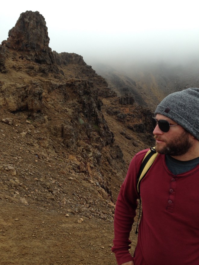
And one of Kirk – we paused for lunch here eating one of my hiking favorites, “adult lunchables”: pepperoni salami, a block of aged extra sharp white cheddar, and seedy crackers 😍
Unfortunately, almost as soon as we arrived here, a thicker cloud cover came in and this was the farthest you could see…

This cloud cover stayed the entire time we were on the top. All those views mentioned earlier – we didn’t see a single one! Well, we saw the “emerald” lakes once we were right beside them, but they didn’t look emerald!

Kirk by the lake

The second “emerald” lake.
The other lakes and craters we never got a view of. We hiked for about 14 more kilometers, getting some killer looks as beautifully colored rocks, sliding down those sandy declines I mentioned, and trying to stay dry, but the cloud cover and strong winds had soaked us through by the time of our descent.
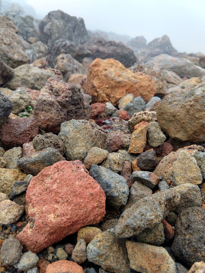
Look at all that color! Rocks like this lined the trail down.
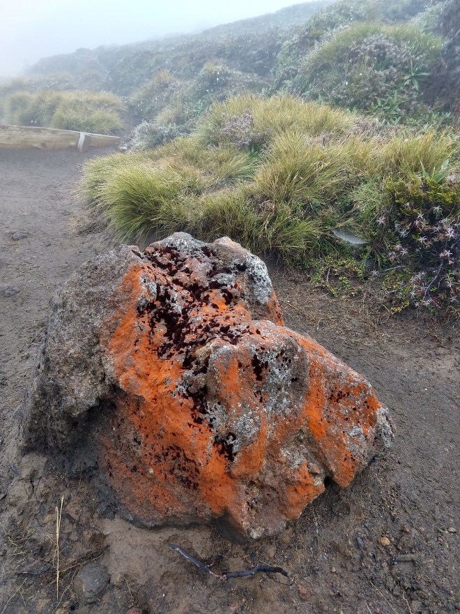
This orange covered so many of the rocks. It was beautiful against the dark volcanic stones.
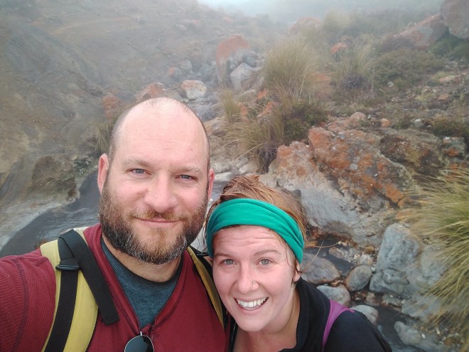
Us in front of one of the river beds filled with orange covered rocks. If you can’t tell, my hair is soaked through from the clouds!
Eventually we came down out of the clouds and Kirk turned back to take a picture.

You couldn’t see the tallest peaks anymore!
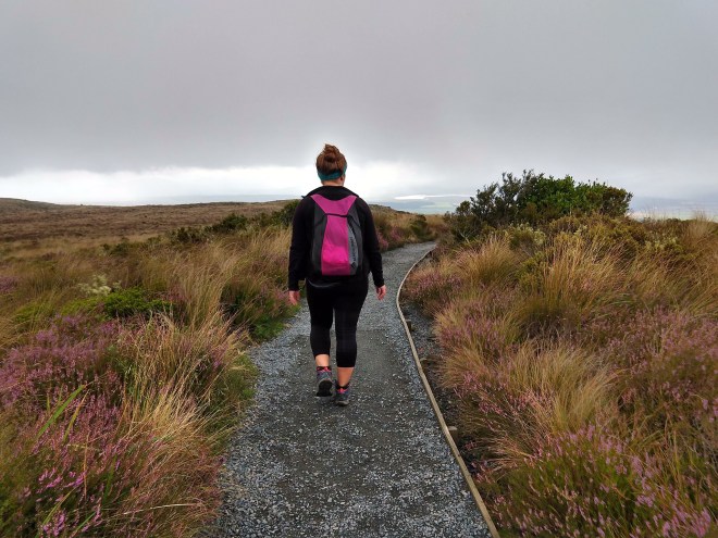
The views on our way down were similar to those with which we started. Flowers, greenery, windy paths. As we left those views we came to a forest where everything was vibrant green.

Eventually we came to this sign – I’m still unsure what noise we should have been listening for, but we came out alright, so it must have been okay!
We ended our hike exhausted. We walked a pretty difficult 19 kilometers (12 miles) to see mostly fog! If we ever go back, I think we’ll try it again, but only if it’s a very clear day!
Also, I mentioned in our “Torres Del Paine” blog that it was impossible for us to finish the hike in the time slots they had listed, but I’m proud to report that this hike said it took 5-8 hours and we finished in 6 hours and 15 minutes (and that includes a lunch break)! It probably would have taken longer if we’d have been able to see the views because I would have wanted pictures of them all, but it felt so good to finish in the shorter end of the time slot 🤗!
Here’s one more pic of Mt Doom from the first time we spotted it, driving into town.
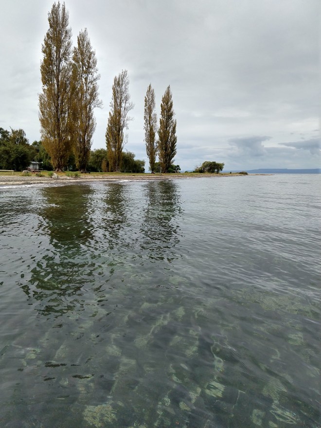
After the hike we stayed near the lake a few days, exploring around there. The water was so clear and the shore held tons of volcanic stones that floated.

—
—

Not the greatest picture, but that giant rock, it floated 🙂
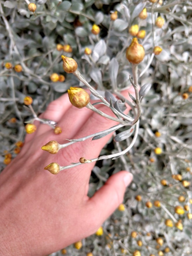
Check out this plant we found walking around one day – it’s naturally shiny, though the shimmer looks like something I only though paint could do.
We then headed to the Bay of Plenty to sleep one night before heading to Hobbiton early the next morning. The beaches there were beautiful with cliffs and big rocks all around. There was a small peninsula from which you could hike up and watch the many surfers gliding along the huge waves. There are supposed to be hot water beaches somewhere in the area where you can take a shovel, dig a hole in the sand, and quickly reach ground water so hot that you can’t get in it. We were unable to find the beach, but it had been a long day of driving and we didn’t have a shovel, so we also weren’t trying too hard.
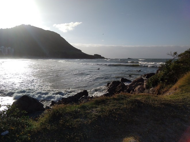
Those are just a couple of the many many surfers out.
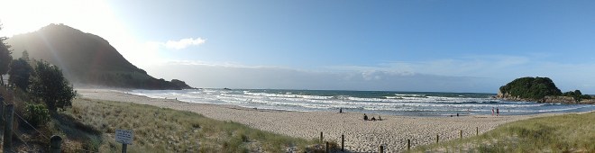
A panoramic view of the beach we visited in the area

The land to the right is part of the peninsula we hiked up
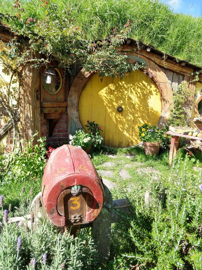
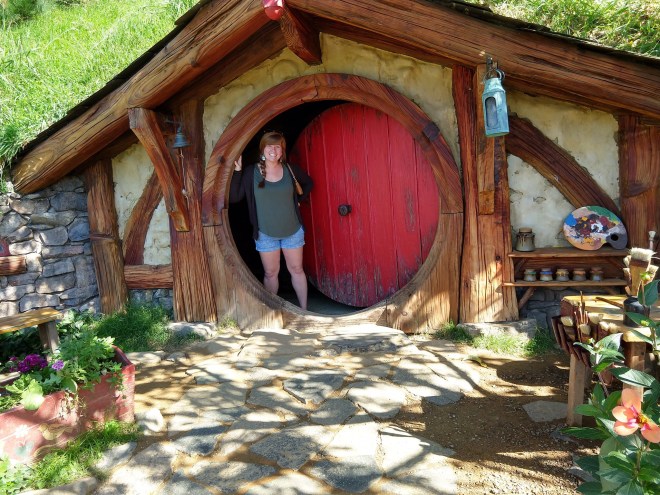
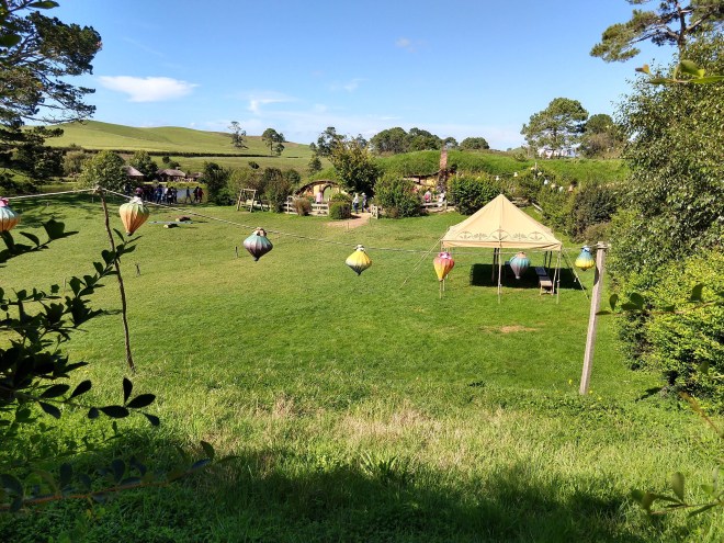
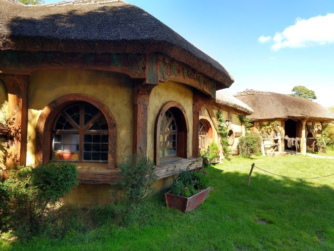
The next day we headed out early to Matamata and traveled with the first tour group of the day to see Hobbiton. This part of the Hobbit film set is located on the bright rolling green hills of a local dairy/sheep farm. It’s beautiful just driving through the pasture, and once you enter into the actual set, you feel like you are apart of the village itself. After Lord of the Rings was filmed, the set was torn down, but so many people visited the empty set (just to see the rolling green hills and place the hobbit “holes” once were), that when they decided to film “The Hobbit”, they rebuilt the entire set permanently, actually digging into the hills and keeping to New Zealand’s building codes. Most of the holes only go about a meter into the hill and, as a tourist, there is only one you can go in to, but it still a pretty mesmerizing place, with no detail overlooked. They meticulously groom the area and everything has a beautifully crafted “aged” look, even though the set itself isn’t very old. At one point we walked past pumpkins in a garden that were humongous, at least 2 feet wide, making the garden feel like a magical place. I assumed they must be crafted, but our tour guide pointed out that the pumpkins are, in fact, real. The groundsmen have a pumpkin growing competition going to help keep up the magical appeal of the area.
Here are some pictures.

The green fields of the dairy farm you pass through right before reaching Hobbiton.
One of the many Hobbit holes

—

An especially memorable hobbit hole.
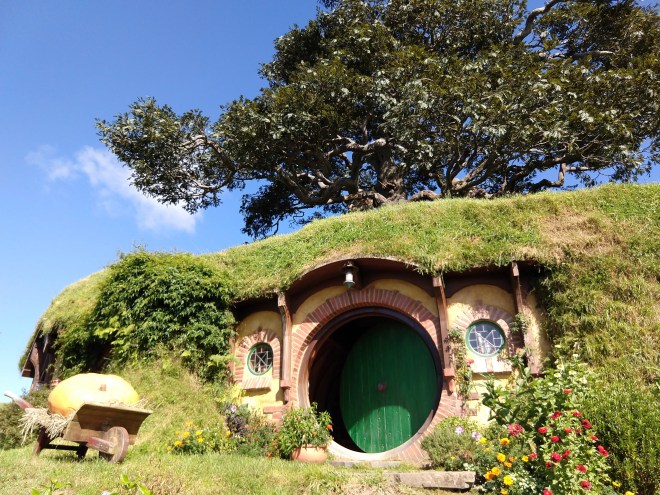
Another view of Bag End with the famous fake tree behind it – and though this pumpkin is fake, it shows the size the real ones were in the garden.
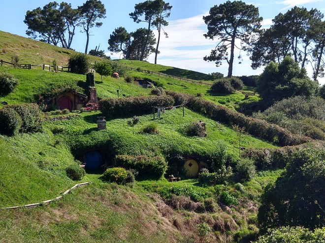 Hobbit holes on a hill.
The one hole you can take a picture in!

—
Where Bilbo’s 111th birthday party occurred. 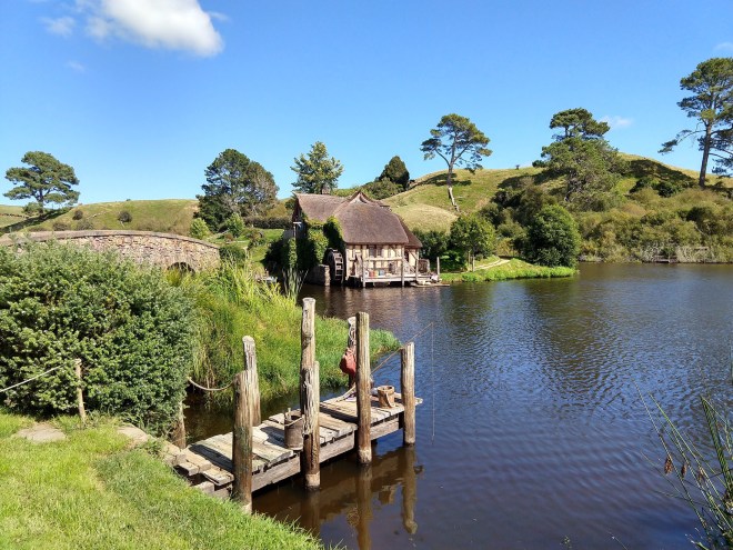
The bridge crossing over to the Green Dragon Inn (behind me)

Entrance to the Green Dragon. They built it life sized, and give you a free drink there at the end – a locally brewed beer, cider, or ginger beer.
The Green Dragon Inn

A stranger saw us sitting together and asked if we wanted our picture taken. It was too dark to turn out great, but it’s a memory!
The rest of our time in New Zealand was spent in the Auckland area. We stayed right outside the city in the home of a vivacious Catholic Argentinian girl and her kind, softer spoken Muslim boyfriend from Saudi Arabia. If I ever saw a case of opposites attracting, this was it. They were so welcoming and fascinating to talk to as they discussed their home countries, politics, religion, and the qualities in the other that they were so attracted to. If you know Kirk, you know he just ate this opportunity up. We both love talking to and taking in learning opportunities from people different than us, and though this was the time that I ended up catching another stomach bug, he had ample time to sit with them while I slept. They were both such lovely, strong individuals who had moved to New Zealand on their own and learned English after arriving. I think that’s a pretty brave thing to do!
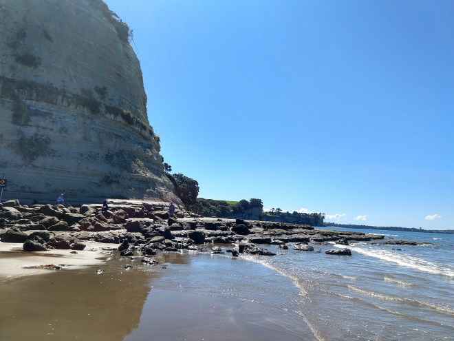
Prior to catching the stomach bug, we did get a chance to visit one of the many beaches in the area. I’ll leave you with a picture from there.
Next post, Vanuatu!

Oh, wow!!! Thank you for taking me to Hobbiton! I read The Hobbit series, when I was in my late 20’s…in the forever plus years ago. Long before the movie ever was thought about, and it was in my creative imagination that I created their homeland. And, now, to actually see it!! Heart be still!
Oh, and your hike! Truly a breathtaking (literally, 😄) experience! Those orange rocks were gorgeous! And that golden little plant with pods that shimmered under the gray clouds…painted with God’s paint brush…were beautiful! Thank you for sharing the little, as well as the obvious, beauty in nature!!
I can’t wait to see what lies around the next bend in your journey! Praying for you!
Hugs… Jann
LikeLiked by 1 person
Wow! Absolutely stunning scenery! Your descriptions are wonderful and make me want to visit. I️ also love seeing the pictures of you and Kirk. Miss y’all so so much!
Karen
Sent from my iPad
>
LikeLiked by 1 person